|
what is that, the lights
you'd think they'd have internet
with all that power
|
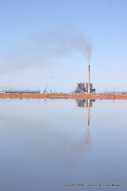
The intertubes failed us. The hotel was down. Shoot, even Mackers was down. (That's McDonald's to you and me.) Judging by the brown plume trailing away from the tall stack to the south of town, it is not a lack of electricity...
|
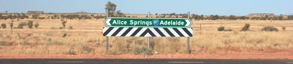
Maps, Not GPS: Believe it or not, we like maps. We do not own a GPS and probably never will.
We met a nice family in the Melbourne airport. When we told them we were "planning" to drive the outback, they helpfully offered that we needed a GPS.
We returned that we had a compass and would just get a map.
The blank and almost frightened look on their faces was worth the trip.
Why maps? Maps show you all the possibilities and you decide among them. A good map also gives you hints at the topography, side adventures and a host of things to get you into trouble.
Yeah maps!
|
Lea Ann had a class to attend at 7pm on Tuesday night. Given the time difference, the rotation of the earth, and the Democratic majority in Congress, it took us several days to figure out exactly what day and time that would be in Australia.
Turns out, to attend class at 7pm on Tuesday night in Virginia, Lea Ann had to be online at 8:30am on Wednesday. We also had to be at a place that had internet.
This last bit became the real stumbling block. We picked out our hotel (at least in part) because thye had internet free in all the rooms. Of course, check out time all over South Australia seems to be 10:00am. Since class is over at 11:15am (S.A. Time), we negotiated a late check out. All that is settled.
Nothing is that simple, of course. In the morning, the internet did not work. We suppose that somewhere the internet was working, but not here at our hotel. We asked about it and they said something that translated to, "Yeah, we have no idea, sorry.". They were very nice about it. Clueless, but nice.
Plan B? We had noticed that the McDonald's are advertising free Wi-Fi in all restaurants. So, off to Mackers to buy the second worst latte we had in all of Australia and attempt to log into class via skype.
Skype is simple to use. Unfortunately, electricity is not simple to generate (no plugs available) and Murphy's Law still applies in Australia, on vacation, and on the internet.
Despite Lea Ann's best efforts, she could not contact anyone in class via skype. Stuart attempted to contact some folks and could not succeed either. We had two computers logged into Mackers' Wi-Fi and two sub-par lattes and still no success. Maybe we needed more and better lattes.
Eventually, we apologized to our professor and bid fond adieu. (But not fondue.) Maybe it was the universe telling us something. What could it have been?
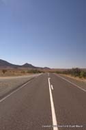
Our plan was to head out of town north through the Flinders Range, eventually to a tiny town called Parachilna, where we would stay the night. Beyond that sketch, we were improvising...
Who are we kidding? That was improvisation.
Port Augusta by Day
We finally purchased a decent set of detailed maps (though not the last we would buy) in Port Augusta at the BP station, where we stopped to take loads more pictures of the power plant.
|
|
The Port Augusta coal-fired power plant was just as impressive by day as by night. Is this picture upside down?
|
|
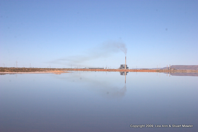
This picture is definitely upside down. Where hass the quality control on personal web sites gone?
Like that brown exhaust? Breathe deeply for that fresh country air!
|
|
|
|
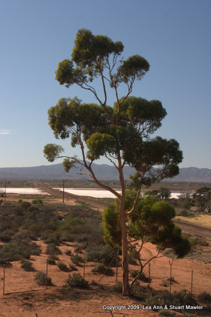
Port Augusta is just about the end of the iconic gum tree before full-fledged desert takes over.
|
|
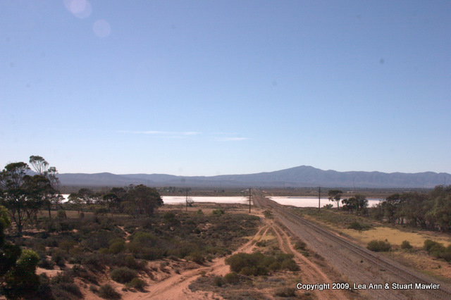
Another salt flat is bisected by the railroad leading up to the coal fields that feed the plant. Not sure how they convince the water to not wash out the rails when they flood the flat.
|
|
Quorn, South Australia
Not much to say about Quorn. There is really not much there, though it is an attractive little place.
|
|
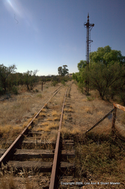
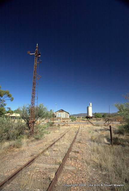
This is the metropolis of Quorn. Don't hold your breath for a train on these tracks.
|
|
Google maps shows this to be the train station for Quorn. Again, you could be waiting a long time for that next train.
|
|
|
|
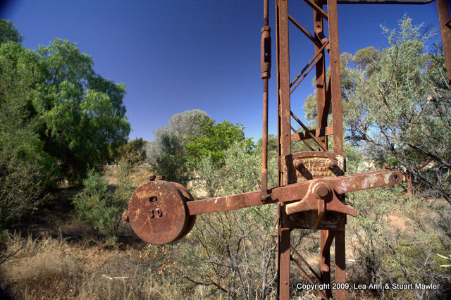
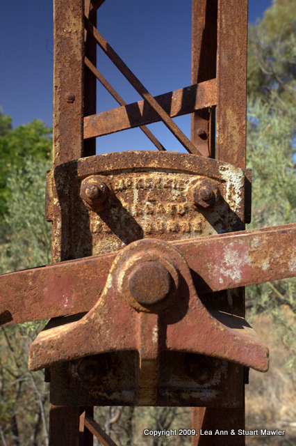
Railroads result in lots of attractively rusty switching equipment.
|
|
Up close, this one looks like McGruff the Crime Dog.
|
|
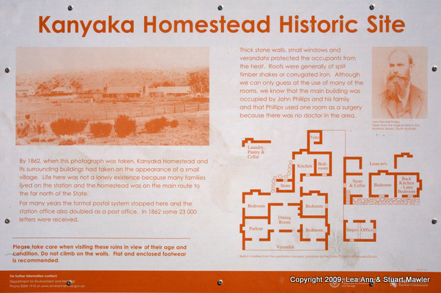
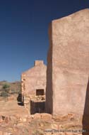
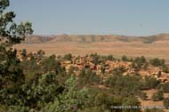
Kanyaka Ruins
The Kanyaka Ruins are the remains of an Outback Homestead that began as a sheep station. The homesteads in the Outback are a bit like small towns and, in many cases, actually larger than the small towns. The homestead system still functions throughout South Australia, though Kanyaka has clearly been abandoned for a long time.
|
|
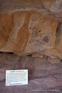
This sign explains that the homestead was the post office, doctor's office, and transportation hub for the area in 1862.
|
|
A nice overview of the stables, the overseer's house, and an outhouse.
This large collection of buildings does not appear on the diagram on the interpretive sign. The complex is far too large for a single sign.
|
|
|
|
|
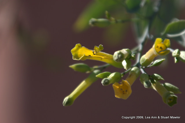
The ruins make a nice back drop for the beautiful desert flowers.
|
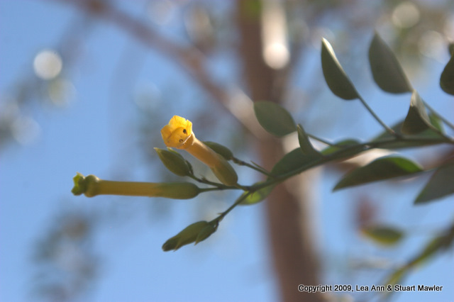
Same flowers, different framing and focal length.
|
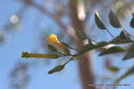
Looks like there might be a bug in the blossom of this one.
|
|
|
These flowers grow right along the ground like something out of Dr. Seuss. The tiny white flowers might only be about 5mm across. If that.
|
|
Knowing how big the flowers are, one can clearly get the idea that this moth is tiny, too.
|
|
|
|
|
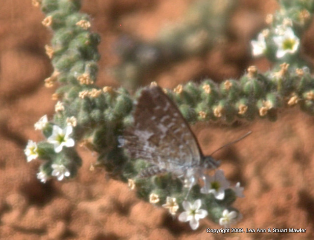
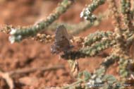
Lea Ann stuck with this pretty little thing, hoping to get just the right picture of the blue color in its wings.
|
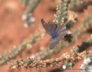
Finally, she caught it with its wings open. Look at that bright blue!
|
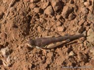
On the slightly less colorful side, we started photographically collecting crickets. Most of the ones we saw in the early part of the trip were brown, but huge. Later, they were crazy colors.
|
|
|
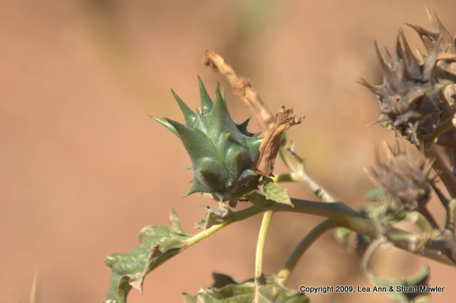
Here is a very angry looking plant. Stuart calls these "gets caught in socks" plants. However, this seed pod is a bit large for most socks, being about the size of a small lemon or lime.
|
|
When they dry up, they look even more angry. We imagined a mask with little eye slits.
|
|
|

|
|
|
Oh yeah, there were ruins here, too...
|
|
|
|
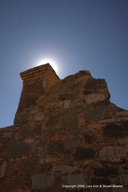
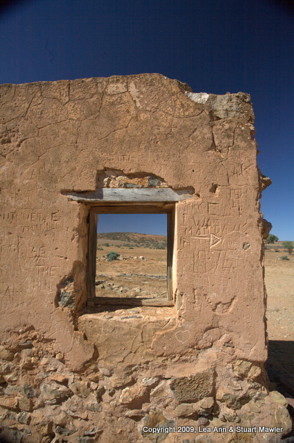
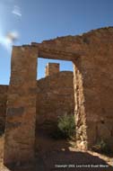
A few people have apparently felt it necessary to add their names to this wall.
|
|
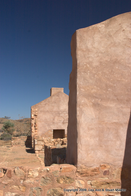
This is the back wall of the stable and one of our favorite pictures.
|
|
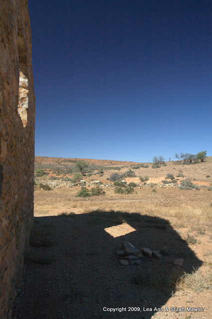
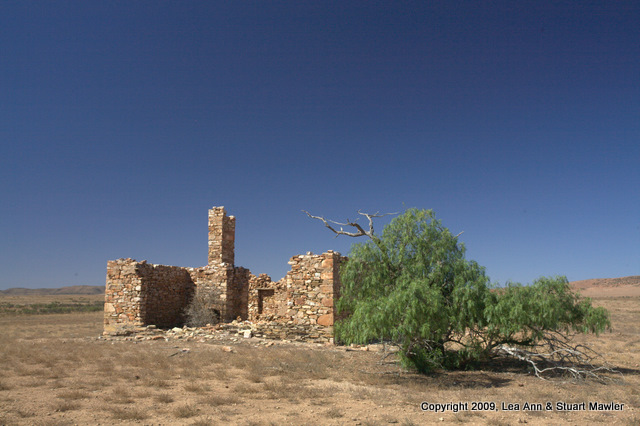
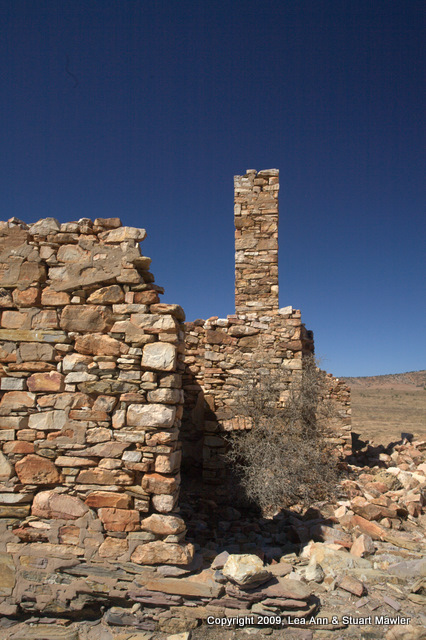
Random Roadside Stop
We have a tendency to pull over at the merest hint of something interesting. Not long after leaving Kanyaka, we saw some other interesting ruins and were compelled to pull over. Eventually, we saw so many ruins, that we were able to control ourselves andd simply drive by.
|
|
|
|
|
|
A nice image that evokes Mad Max... In the distance you can see the peak that marks where we ended up stopping next.
|
|
|
|
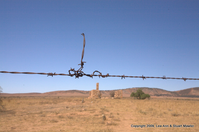
The coil in the barbed wire seems to mimic the chimney of the old house.
|
|
Compared to many of the spots people tried to live, this house is in a very lush location.
|
|
|
|
Wonderful masonry.
They just don't make 'em like they used to. I remember back in my day...
Ahem.
|
|
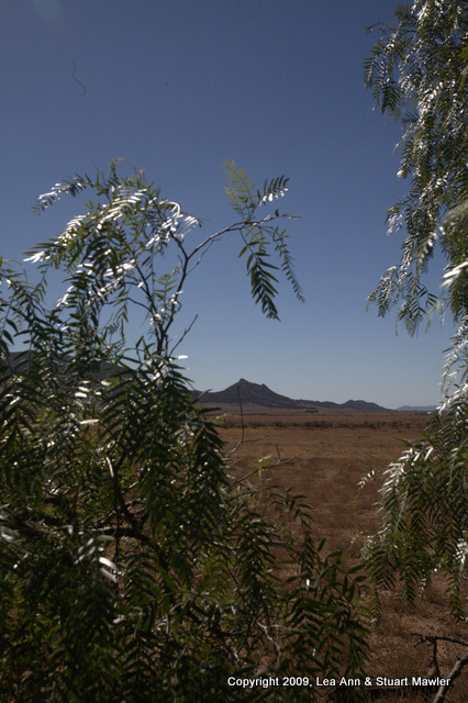
The neat thing about this image is the way the light reflects off the leaves, which frame the lone peak in the distance.
See? Trespassing does pay!
|
|
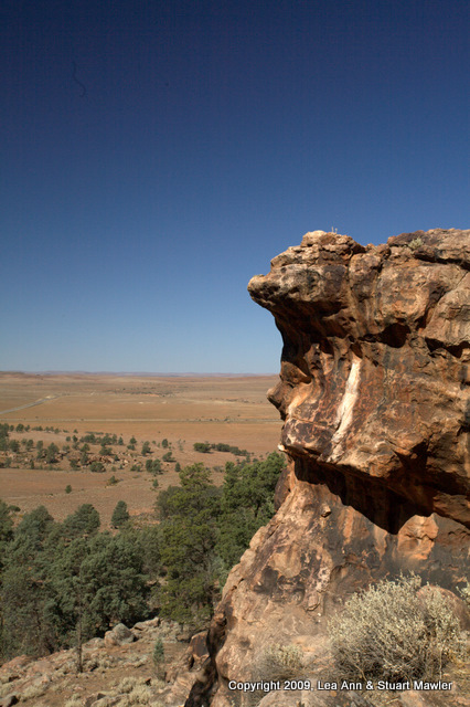
Yourambulla Caves
Only a couple of kilometers after stopping to look at the random roadside ruins, we saw a sign for the Yourambulla Caves. A sign pointing to caves is just too much to pass up, so we turned off to see the Aboriginal art. Turns out, it was a bit of a hike up to the "caves", but both the art and view were worth it.
|
|
|
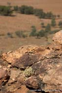
Up near the caves, we could see the other parts of the ridge, highlighting the broken up nature of the rocks.
|
The smooth background (through the wonders of depth of field) contrasts nicely with the sharp rocks of the nearground.
|
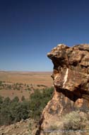
Can you see the face in this rock or is our imagination running away with us?
Hint: that was a rhetorical question.
|
|

|
|
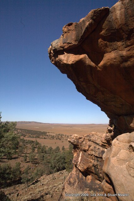
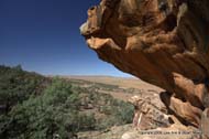
The first two images on this row highlight the overhang.
|
You can also get some appreciation for the distances and the flat nature of the topography everywhere but right here on this ridge.
|
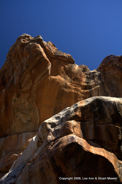
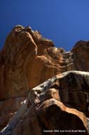
Looking up shows all the colors of the rock and the water markings from the desert downpours.
|
|
|
|
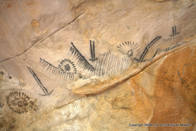
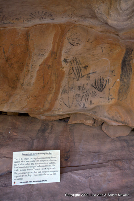
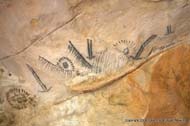
At last, we made it to the actual Aboriginal art.
|
This sign explains:
"This is the largest cave containing paintings in this region. Most were made with manganese, charcoal, red or white ochre. The motifs consist of patterns, hand stencils, line designs and animal tracks. The tracks include those of Emus [two downward pointing arrows] and Kangaroos [a single downward pointing arrow with a hollow shaft]. The paintings were applied with lumps of manganese or painted with fingers dipped in ochre mixed with animal fat."
|
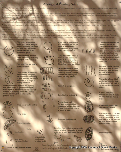
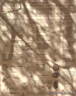
This sign explains the symbols you can see on the cave walls. If you click on it, you can get a better look at the descriptions.
|
|
|
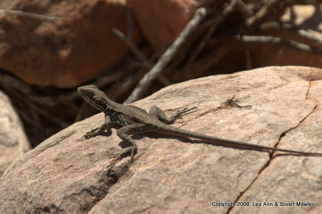
This was the first lizard we saw.
|
|
We like lizards because they are so incredibly cute.
|
|
|
|
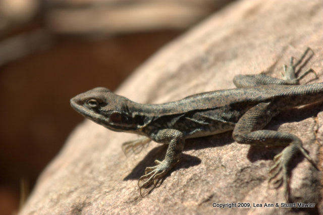
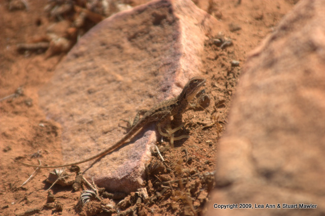
This second lizard is actually much smaller than the grey one above.
|
|
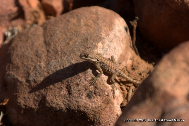
This little character casts a long shadow.
It might be a Ring-tailed Dragon.
|
|
|
|
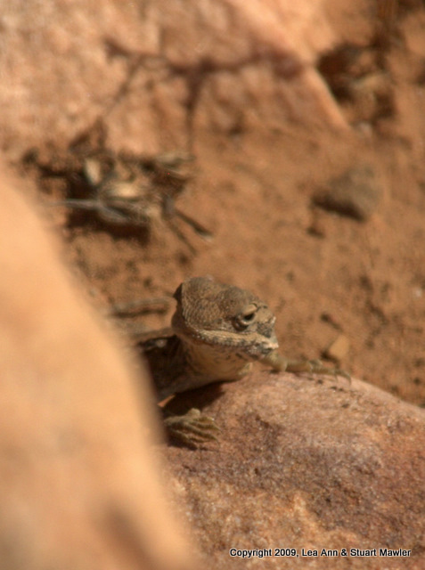
"I am peeking at you!"
It looks kinda like Kermit the Lizard.
|
|
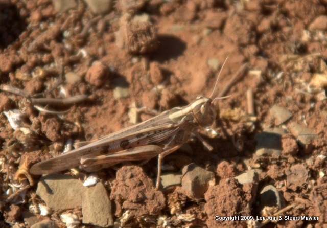
Another cricket for our collection.
|
|
|
|
|
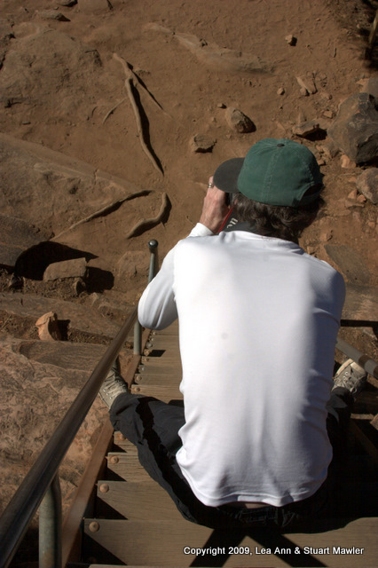
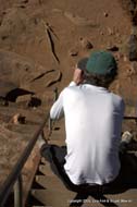
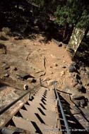
Lea Ann caught Stuart trying to take a picture down the "stairs" that lead up to the paintings.
|
This shows a look down the stairs. Notice the angle at which the rails meet the newel posts... This is one steep set of stairs.
|
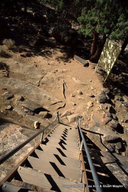
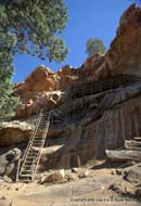
Here is the whole collection of stairs and scaffolding you climb to get a view of the paintings. This is where the sign warns people not to bash their heads.
|
|