Aurora Creative Services is proud to bring you:
Mawlers’ Big Adventure ’04:
Maps!
|
I realized the difficulty most people are having following this long and winding road, so, being the map-crazed person I am, I decided to draw a map. Since my cartography skills far out-weigh any of those poseurs at ADC, Rand McNally, USGS, CGS, YTG, NWTG, etc. Then I calmed down for a moment and decided that there might be another way... What I have collected here is a list of maps, which are all used without permission, but which I have fully attributed to their owners. In most cases, the owners of the maps are public entities, like Yukon Territorial Government (YTG). I have references to their web sites, so you can find out more information about what they have to offer. This way, I borrow their resources, but give them new business in return. Sounds like the old-fashioned barter system to me. Amazing how it still works. I also did some tinkering with the maps to make them more easily relevant to the trip itself. I have highlighted each map with the specific day and linked it from each text and photo page about that area. |
|
|
|
Overall Route |
|
|
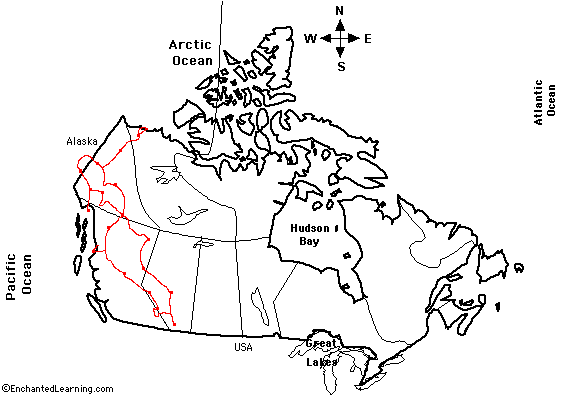 The whole thing, with the stops as slightly larger blobs. Try and find Edmonton. Our route is in red. Map courtesy of: Enchanted Learning |
|
|
|
Maps By Day |
|
|
|
|
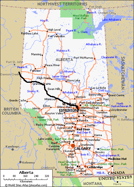 Edmonton, AB to Dawson Creek, BC Map courtesy of: World Sites Atlas Our route is highlighted in black. |
|
|
|
|
|
|
|
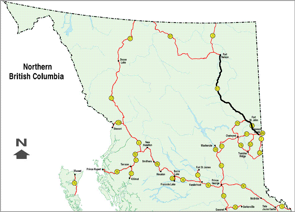 Dawson Creek, BC to Fort Nelson, BC Map courtesy of: British Columbia Provincial Government Our route is highlighted in black. |
|
|
|
|
|
|
|
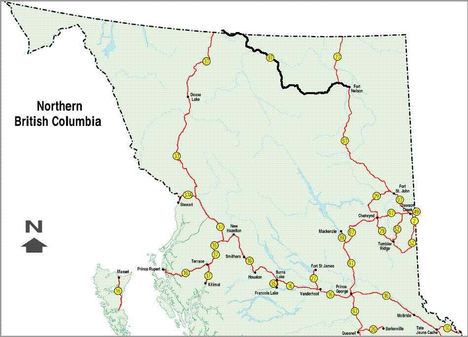 Fort Nelson, BC to Watson Lake, YT Map courtesy of: British Columbia Provincial Government No map covers the end of this route very well. Watson Lake is barely inside the Yukon, so it is is cut off the edge of the Yukon map (only the one from the web, the print copy is excellent) and has no business on a BC map. Oh well. Our route is again highlighted in black. |
|
|
|
|
|
|
|
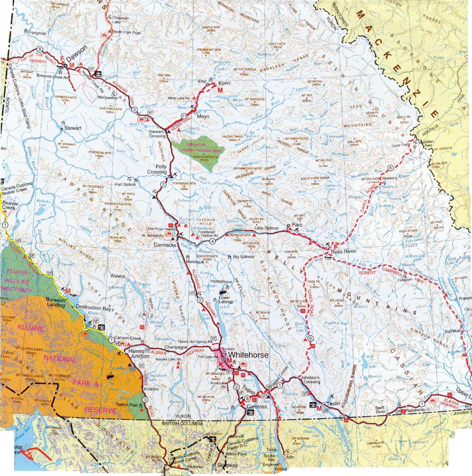
 Watson Lake, YT to Faro, YT Map courtesy of: Yukon Territorial Government Again, Watson Lake does not show up on this map because it just got cut off when they scanned it. Our route starts in the lower right and goes to about the middle of the map. Look for our small side trip on the Nahanni Range Road. Our route is subtly highlighted in bright blue. |
|
|
|
|
|
|
|
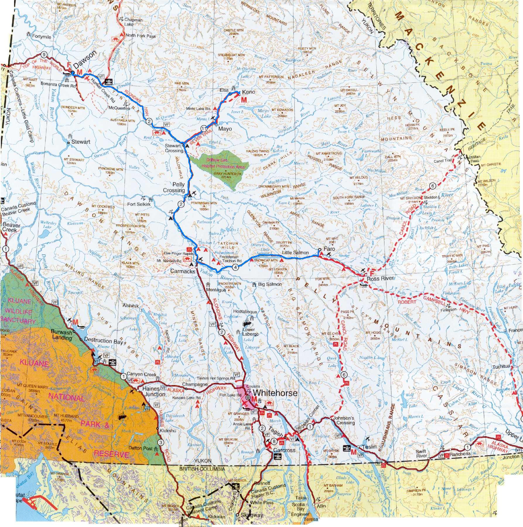 Faro, YT to Dawson City, YT Map courtesy of: Yukon Territorial Government Our route is subtly highlighted in bright blue. |
|
|
|
|
|
|
|
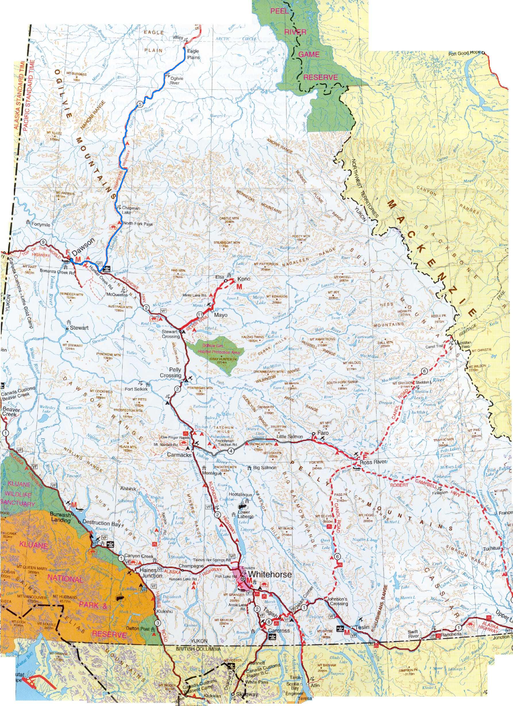 Dawson City, YT to Eagle Plains, YT Map courtesy of: Yukon Territorial Government Our route is again highlighted in bright blue. |
|
|
|
|
|
|
|
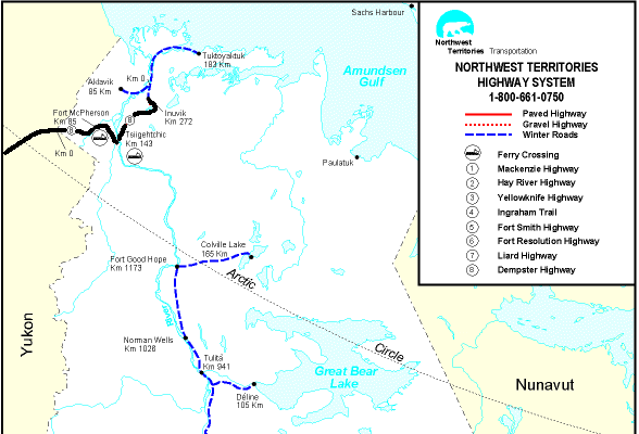 Eagle Plains, YT to Inuvik, NT Map courtesy of: Northwest Territories Territorial Government As with Watson Lake, no one really wants to cover the no-man's land between Eagle Plains and the NWT border. Also, there was one glitch with the NWTG map, where it showed the road going west of Campbell Lake, but I moved it when I drew in our route. Our route is highlighted in black. |
|
|
|
|
|
|
|
 Inuvik, NT to Tuktoyaktuk, NT Map courtesy of: Northwest Territories Territorial Government This route was all by air. I have marked only the outbound trip as a dotted black line. The return trip pretty much followed the blue ice-road marked along the coastline. |
|
|
|
|
|
|
|
 Inuvik, NT to Eagle Plains, YT Map courtesy of: Northwest Territories Territorial Government Our route is highlighted in black. |
|
|
|
|
|
|
|
 Eagle Plains, YT to Dawson City, YT Map courtesy of: Yukon Territorial Government Our route is highlighted in bright blue. |
|
|
|
|
|
|
|
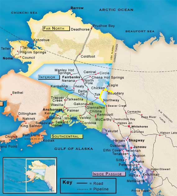 Dawson City, YT to Border City, AK Map courtesy of: Travel Alaska This map shows just how little of Alaska we managed to visit. Our route is highlighted in yellow. |
|
|
|
|
|
|
|
 Border City, AK to Haines Junction, YT Map courtesy of: Yukon Territorial Government The scanner cut off the west edge of the map, just like the east edge, but only by a tiny bit. Our route is highlighted in yellow. |
|
|
|
|
|
|
|
 Haines Junction, YT, to Haines, AK (and back) Map courtesy of: Travel Alaska Again, only a fraction of Alaska. In this case, the return route is the same and does not get its own map. On the return, we actually stopped a few KM shy of Haines Junction. Our route is highlighted in yellow. |
|
|
|
|
|
|
|
 Haines Junction, YT, to Whitehorse, YT Map courtesy of: Yukon Territorial Government This map shows the actual starting point at Kathleen Lake, just a few KM south of Haines Junction. Our route is highlighted in yellow. |
|
|
|
|
|
|
|
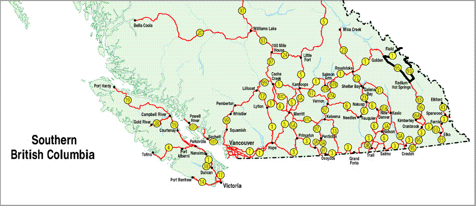
 Whitehorse, YT to Simmons Lake, BC (up through Watson Lake) Map courtesy of: Yukon Territorial Government 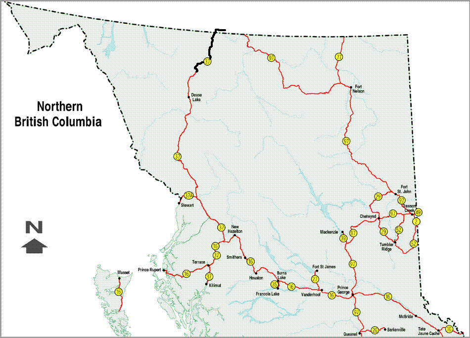 Whitehorse, YT to Simmons Lake, BC (from Watson Lake south) Map courtesy of: British Columbia Provincial Government This was such a busy day, that it takes two maps. Our route is higlighted in yellow on the first map and in black on the second. |
|
|
|
|
|
|
|
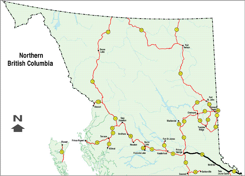
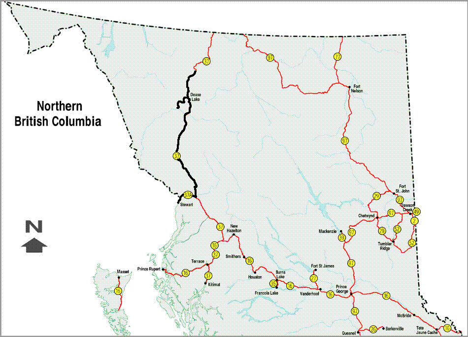 Simmons Lake, BC to Stewart, BC / Hyder, AK Map courtesy of: British Columbia Provincial Government I included our side trip out of Dease Lake. The road was a bit curvey. Our route is highlighted in black. |
|
|
|
|
|
|
|
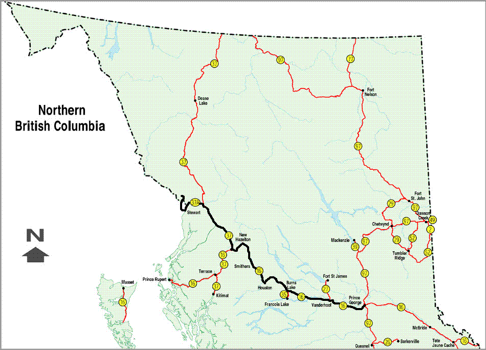 Stewart, BC / Hyder, AK to Prince George, BC Map courtesy of: British Columbia Provincial Government I tried to give a sense of our side trip up to the Salmon Glacier and Granduc copper mine, but it just looks small. Our route is highlighted in black. |
|
|
|
|
|
|
|
 Prince George, BC to Jasper, AB (up to the border) Map courtesy of: British Columbia Provincial Government 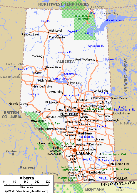 Prince George, BC to Jasper, AB (from the border to Jasper) Map courtesy of: World Sites Atlas Again, it took two maps. Probably not the last time, either. Our route is highlighted in black. |
|
|
|
|
|
|
|
 Jasper, AB to Lake Louise, AB Map courtesy of: World Sites Atlas What an easy driving day! Our route is highlighted in black. |
|
|
|
|
|
|
|
 Lake Louise, AB to Fort MacLeod, AB (from the border of BC) Map courtesy of: British Columbia Provincial Government 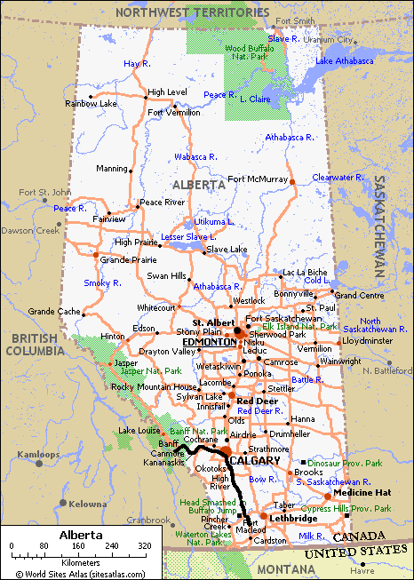 Lake Louise, AB to Fort MacLeod, AB (from Banff south) Map courtesy of: World Sites Atlas Two maps again. Last time, I swear. Our route is highlighted in black. |
|
|
|
|
|
|
|
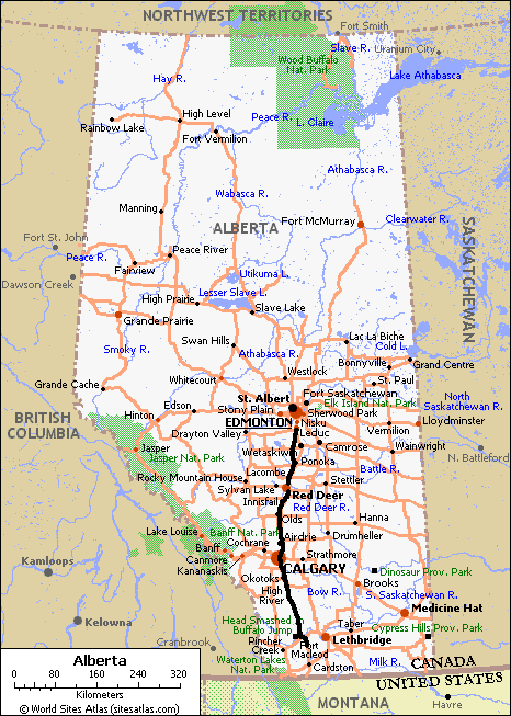 Fort MacLeod, AB to LeDuc/Edmonton, AB Map courtesy of: World Sites Atlas Last day of driving. This turned out to be a bit longer than we intended. Our route is highlighted in black. |
|
|
|
Map Credits |
|
|
|
Enchanted Learning: Label Canadian Provinces and Territories I used this map because it is a good cause (education) and most of our readers could use to know more about Canada. This site is user-supported, so consider contributing. They do not really ask for much. |
|
|
|
|
|
Yukon Territorial Government Maps page This page has many excellent maps and I borrowed the detailed road map, which is great for a number of reasons. First, it is a great representation of what you will see up there and second (and most important) it is a scan of the map that they hand out to tourists. Needless to say, ours is dog-eared and ratty, but looks a lot like this one. It is posted in the transportation section of the page, near the bottom. |
|
|
|
|
|
Northwest Territories Government Highway Conditions page This page is a must-see / must-use if you plan to visit the far north. This is critically important if you are going outside of the core summer months when the ferries might be closing, the ice roads might not yet be open, there might be weight limits on the ice crossings, etc. I borrowed the excellent map available under the "NWT Highway Map" link right up at the top. |
|
|
|
|
|
British Columbia Provincial Government Visitors' Resource page This page has quite a few links, including an "A-Z Index" near the bottom. I followed the "Driving in British Columbia" link to find a page with "Route Information" as an option. On that page, you can see a link for "BC Road Maps" under the "Other Links" heading.the BC map I am using here. They divide the maps between southern BC ad northern BC. Obviously, there are a lot more roads in the south. |
|
|
|
|
|
Official State of Alaska Visitor Information Website I did not see this site before we set out on the trip. Of course, we really only hit the barest sliver of Alaska as you can see from the map I borrowed. The map came from the top link on the main page called "Maps of Alaska" (original eh?). I selected the Alaska Road Map. |
|
|
|
|
|
World Sites Atlas, Hotel and road map of Alberta Sadly, I could not find a road map on the Alberta Provincial Government Site, but I think this one will do nicely. This is a travel-related site, from what I can tell. |
|
|
Back to Great White North Trip main page
Back to Mawler Home
Text and map modifications © 2004 Lea Ann Mawler & Stuart Mawler; maps © to their respective organizations, as noted above