|
ruins, white feathers
tall wind, brown dust, desert mine
here's the rain at last
|
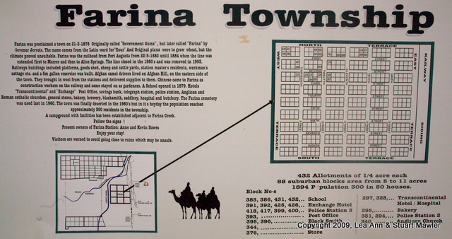
Just north of Leigh Creek is the town of Farina. If you look it up on Google Maps, you will be impressed with the lush area. Zoom in and switch to "map" view and you can see all the streets marked in town. Problem is, no one lives there. This sign, positioned approximately on lot 344, explains the town.
Reproduced as faithfully as possible, the sign explains:
Farina was proclaimed a town on 21-3-1878 Originally called "Government Gums", but later called "Farina" by Governor Jervois. The name comes from the Latin word for "flour" And Original plans were to grow wheat, but the climate proved unsuitable. Farina was the railhead from Port Augusta from 22-5-1882 until 1884 when the line was extended first to Marree and then to Alice Springs. The line closed in the 1980 s and was removed in 1993. Railways buildings included platforms, goods shed, sheep and cattle yards, station master s residents, workman's cottage, etc. and a 5m gallon reservoir was built. Afghan camel drivers lived on Afghan Hill, on the eastern side of the town. They brought in wool from the stations and delivered supplies to them. Chinese came to Farina as construction workers on the railway and some stayed on as gardeners. A School opened in 1879. Hotels "Transcontinental" and "Exchange" Post Office, savings bank, telegraph station, police station, Anglican and Roman catholic churches, general stores, bakery, brewery, blacksmith, saddlery, hospital and butchery. The Farina cemetery was used last in 1960. The town was finally deserted in the 1980's but in its heyday the population reached approximately 300 residents in the township.
Of particular interest is that the "station master s residents" were apparently buildings... It is nice to see that this sign conforms to the universal requirement that local historical signs receive little editing or fact-checking. Much like most of the wrold wied webb.
The most notable thing on this sign is actually that they thought it would be a good idea to grow wheat. Their truly classic understatement acknowledges that "the climate proved unsuitable".
Did you look at the satelite image on Google Maps? Who thought it would be a good idea to grow anything here?
Now that is what we call optimism! (Or insanity, or self-delusion...)
On the plus side, we end up with both an awesome touching story of a town that just disappeared and a picturesque ghost town. One person's misfortune is another's photo op. Break out the cameras.
We are pretty sure that this is the oath taken by all photo journalists.
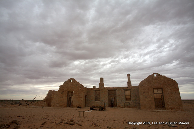
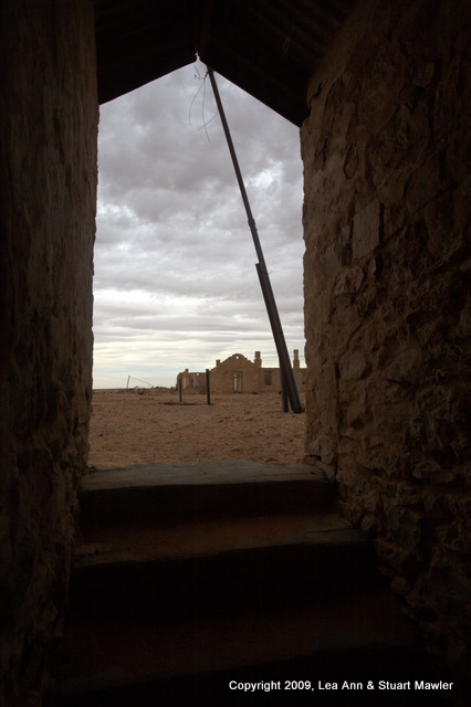
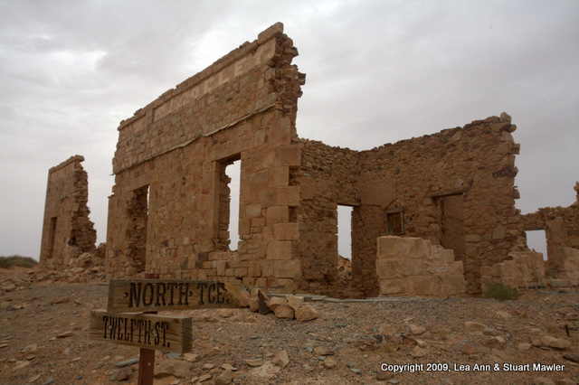
The current owners of the town have marked some of the streets, so you can get a better sense of things. The largest ruin here is the Transcontinental Hotel, which also served as hospital and post office at various points in the town's arc.
As you can see, the dramatically stormy sky stayed with us. In some ways, it makes the scene all that much more spooky, lonely, and desolate.
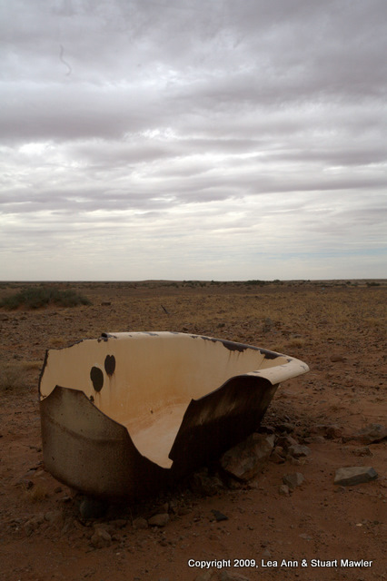
On the whole, much of the detritus left in town makes it appear as though the people just dropped everything on a given day and walked away. The picture to the right is of the Transcontinental Hotel from inside the bakery. It looks like bread was made in here not long ago. Of course, there are bathtubs, flatbed trucks, wagons, clothes washers, etc. Kinda creepy, really.
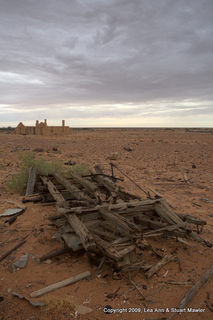
In the picture below and to the right, there are several things to note. Just below the horizon on the right are the remains of a wagon (also seen in the right image of the two above). To the left of the wagon remains and a bit farther away are the remains of a flatbed Model-T truck. On the far horizon, just above and to the left of the Model-T, are the ruins of a house. One might consider that the suburbs of Farina.
In addition to the specifically identifiable items in the picture, you can see small bits of building materials, household items, and vehicle parts everywhere.
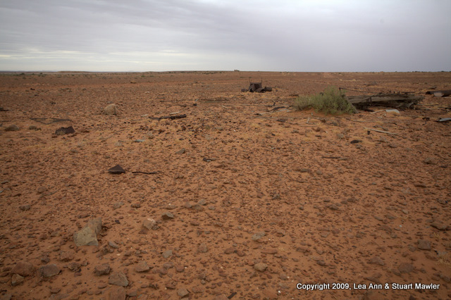
Then take a second to look at the quality of the ground here at what was the center of town. Again we ask: Wheat? Really? Why did that seem like a good idea?
Last note, if you look near the horizon on the left of the image, you can see the Mars rover, searching for evidence of water. It has not found any.
While we do not yet know the style that human colonies on Mars will take (go ahead and laugh, but that was the best transition we could arrange on short notice), every colonial effort has a style.
That style extends to the layout of towns. In South Australia, the typical town is a perfect rectilinear grid, oriented to the primary compass points. You can see the grid in in the town layout on the sign at the top of the page. Downtown Adelaide follows this form. Farina follows the form. Marree follows the form (though we don't know that yet, since we have not arrived).
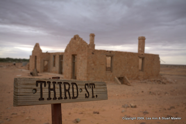
A key part of this traditional layout is that the streets bordering the grid are called "Terraces". (Abbreviated "TCE".) There is almost always a "North Terrace", "South Terrace", "East Terrace", and "West Terrace". The remains of a store stand at the corner of North Terrace and Twelfth Streets in what is left of Farina.
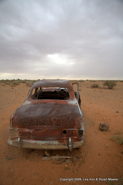
Finally, on the way out of town, we came across this car. It is parked facing the main north-south road and the Old Ghan Railway. Considering the age of the car, it is in good shape. As if the owner had intended to leave town, but forgot his or her car in the process.
Adding to the peculiarity was what we found in the car. On the tattered remains of the seat, there was a tube of toothpaste. Just that little detail out of everyday life seemed to heighten the feeling of a place stopped in time; all the things that one does in a day are just left behind. Also, it is now clear that when deserting a town, proper oral hygiene is vitally important.
However, despite all the other reasons why a town might not succeed in this environment, we found the real reason this town had been deserted...
The Birds!
While Stuart spent an inordinate amount of time taking pictures of dead things, Lea Ann was doing her best to chase down the vile creatures who had so brutally decimated this town... Or so Hitchcock might have you believe.
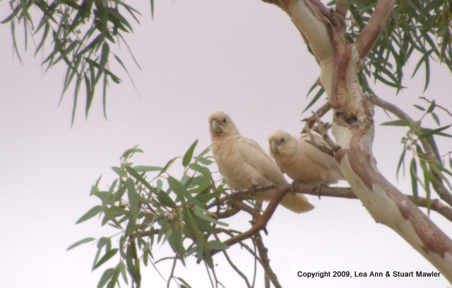
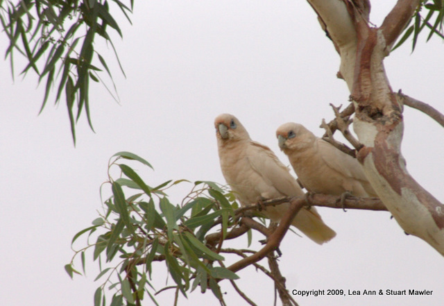
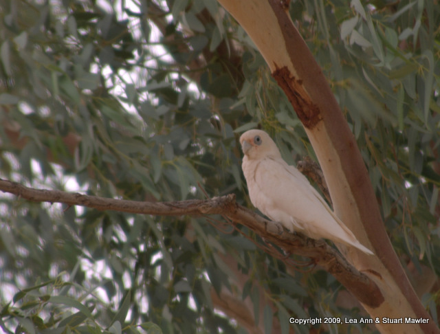
Rather, she was taking pictures of cute white birds called Little Corellas cavorting in mating pairs and probably wondering if she had anything good to eat.
Here are a couple of shots a particularly cute pair:
In the picture below left, it looks like the boy has fallen asleep on his favorite branch, with his sweetie snuggled up next to him. By contrast, the picture below right gives the impression of a cantankerous couple saying the avian equivalent of "get off my lawn!".
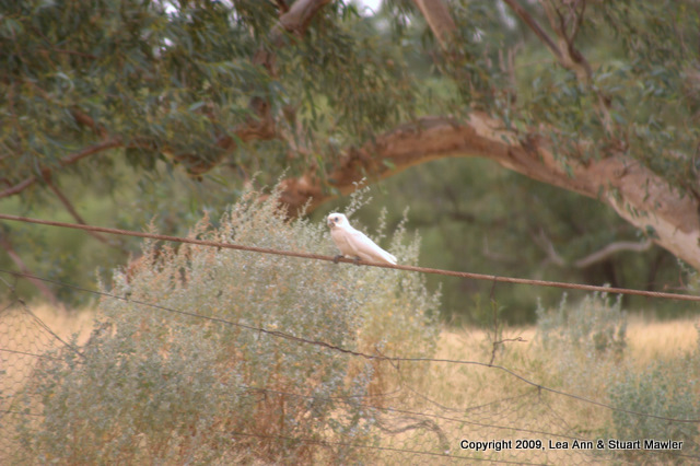
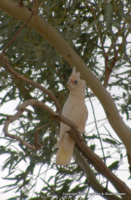
They don't always come in pairs, though. Here are a couple giving the camera weird looks, with the one on the right showing the crest:
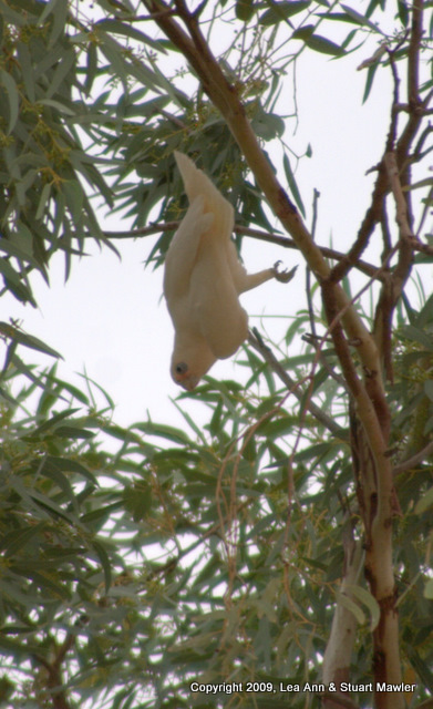
This little guy was the best though. He kept spinning around the branch and then dangling by one claw. Must have been eating some wild poppies.
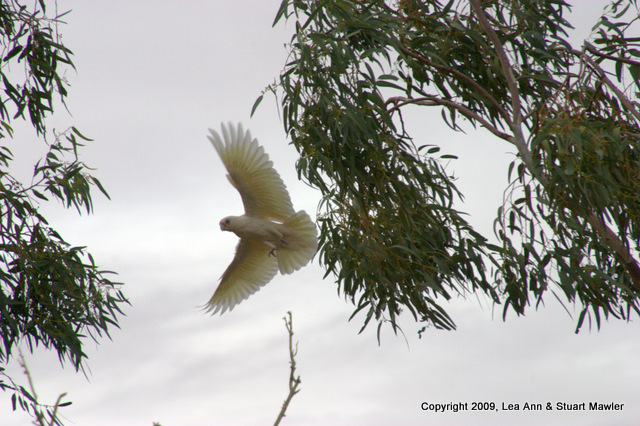
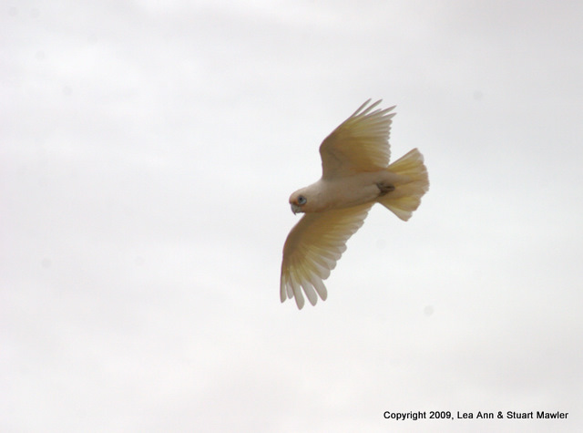
As usual, Lea Ann's persistence paid off, though. Not only did she prove Hitchcock wrong, she was able to capture these two wonderful shots of Little Corellas in flight.
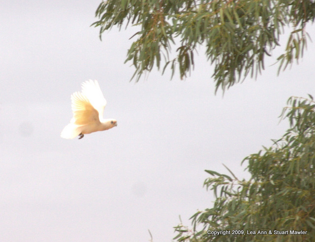
And if that were not enough, Lea Ann captured this picture of the Little Corella Messenger of GodTM: When your message absolutely must be delivered to a lone gum tree in the middle of nowhere.
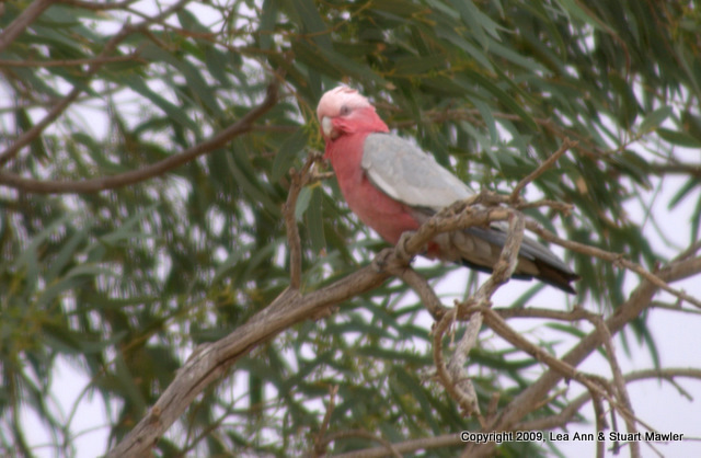
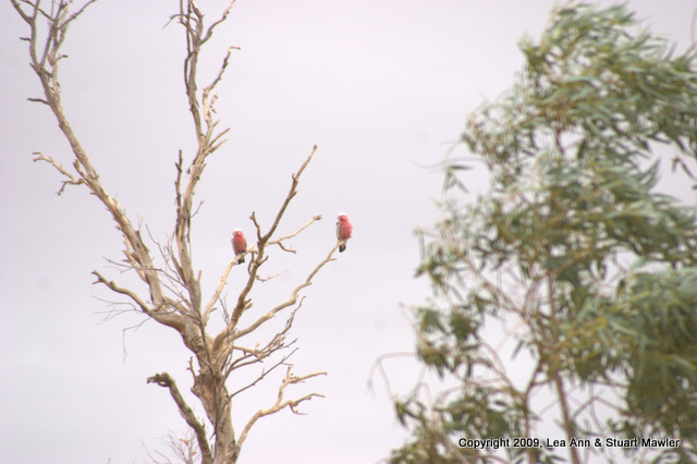
Of course, it was not all Corellas all the time. There were also Gallahs... The picture on the right is one of our favorites because the tree on the left with the birds is so sharp compared to the eucalyptus in the right distance.
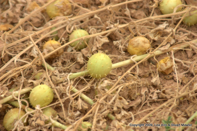
The undergrowth can tend to be a bit inhospitable. In the picture below left, this "fruit" looks more like some medieval armament. That spiky nature ends up catching a few feathers, from time to time, as in the Gallah feather caught below left.
Finally, we had taken enough pictures of birds and detritus that we could leave feeling satisfied. On the way out though, we paused to take a picture of a tiny song bird "surfing" the rising winds on the branch of a small scrub bush.
The increasing darkness of our pictures seems to indicate inclement weather...
Driving toward Marree, the clouds opened up and we started to see the rain that had been threatening all day. It was mostly a sprinkle, but it built up across the evening to the point where we decided to get a room in Marree relatively early, rather than be out on the road in a big storm. Of course, we did find time for a side-trip a few kilometers up the Birdsville Track.
|