|
early knock. washed out
flying over the salt lake
gone into the wild
|
After a night of unbroken downpour, we awoke to find that the rain had crept in under the door of our "room" at the Marree Hotel. We discovered this when someone knocked on our door early in the morning... It seems housekeeping is the same everywhere...
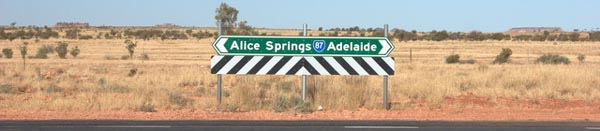
Finding the damp carpet and subsequently negotiating the moat that had formed around our truck, we began to be concerned about the state of our route out of town. We intended to head north on the Oodnadatta Track, stopping at some weird stuff along the way, but there is the issue of the "floodways", which were mentioned on the signs page.
These low spots fill up in heavy rain conditions... Like last night.
We decided to stop first to see what they had for breakfast, since it came with the room. In short, wheat, bad coffee, and bad tea. Ah well. Off we go.
As we checked out of the hotel, we noted that the street out front was covered with thick red mud, recently deposited. Not lookin' good.
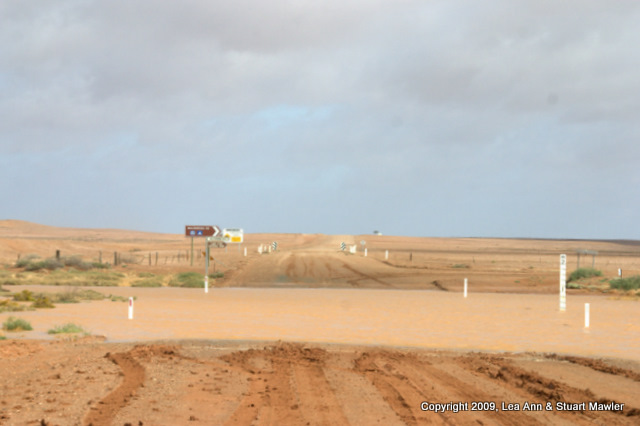
Just beyond north edge of town is the first floodway. As we left the official town boundary, we began to note a number of people in SUVs like ours, pulled over to various sides of the road, as well as some motorcycles. Approaching one of the SUVs, the driver and passenger noted that everyone was waiting because the water across the road looked too deep. About this time, we noted the motorcycle riders pushing their bikes backwards up the completely churned road.
Except for the red tint, it looked a lot like we should be assaulting Russia in springtime.
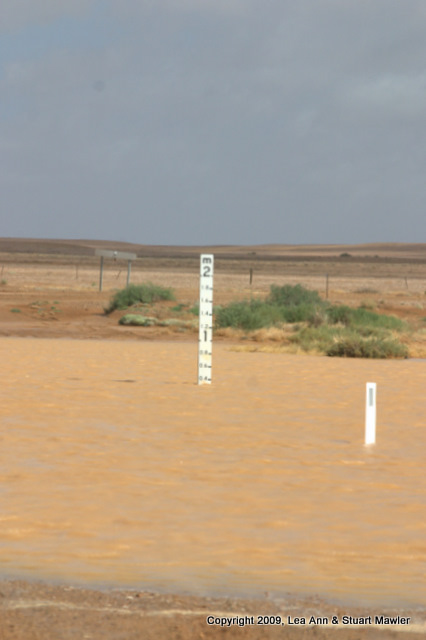
Conveniently, most floodways include a gauge that marks meters in tenths from zero at the bottom up to 2m (usually). This makes it easy to see just how deep the river up which you will be without a paddle, should you hastily drive or walk across. When we were close enough to get a good look, the gauge here said 0.4 meters.
The main problem with the handy dandy gauge is that, while the maintenance crews try hard, the zero mark is not necessarily at the lowest point. Water has a tendency to change the roadbed. Further, there is no guarantee of the road surface under the murky water. It could be concrete (which they are adding in more places all the time), it could be bare rock, or it could be a thick red ooze. That latter would be very bad, particularly with street tires on your SUV.
Now, we know that several of our friends (were they to know any metric) would be thinking that 0.4 meters is just under half a meter, which makes the water approximately 1.312335958 feet deep [a conversion done in my head, let me assure you - sm]. Rural Virginia was once full of creek bottom crossings ("fords" in the creeks), so we were far from unfamiliar with such things. However, we were also far from civilization in a rented SUV. Caution was probably warranted.
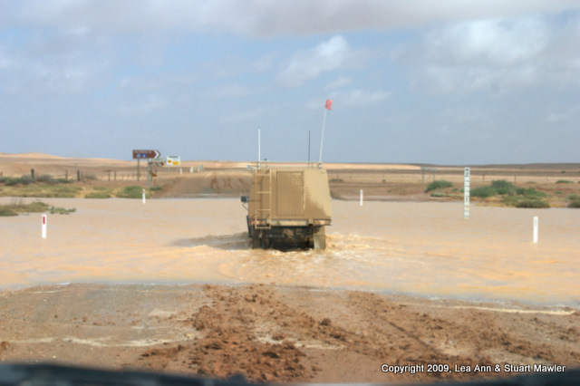
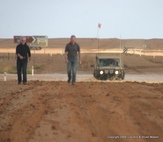
We sat there for quite a while thinking about giving it a go. Eventually, a local drove up in a giant Toyota with knobby tires and a snorkel. He pulled up next to us and said, quite matter-of-factly, "That's probably too deep for you. We'll see in a minute". He then drove off through the low spot, just to see how deep it was.
Watching that performance, we decided that we should probably wait for a few hours before crossing. Besides, if this floodway was covered, it was highly likely that others would be, as well.
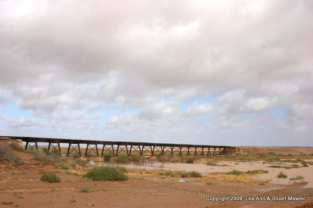
While a bit at a loss for what to do next, we did manage to take a picture of the Old Ghan Railway trestle over the very creek blocking our path, which you can see to the right. The Old Ghan was closed because it was too hard to maintain the numerous creek crossings. Ironically, this particular crossing has not been maintained in 20 years, but looks like it would take a train right now.
We commenced backing up toward town... That's the problem with a hard pack dirt road in the desert; when it rains heavily, the road gets really soft. And that means that the shoulders are like fluff. Three-point turns (k-turns, whatever) are not to be taken lightly.
Before we had gone far, the local in the Toyota, who was clearly just out for a joy ride to irritate the tourists, came back across the creek. At about the same time, two of the motorcycle riders were walking back, having officially given up for the day. The resulting picture looks like something out of Mad Max or perhaps a modern version of a Spaghetti Western.
Ok, so now what? We are stuck in a dinky little town that is decidedly not hip with a long way to go yet today, since we are trying to make Coober Pedy by tonight. We would rather have been stranded in Parachilna, frankly.
How about a sight-seeing flight?
It turns out that Marree is quite close to Lake Eyre.
Getting a look at the lake can be pretty tricky considering that it changes size drastically through wind and evaporation. Hence, you might not be able to get near enough for a good view.
We stopped in at the corner store at the north end of town, where all activities are centered, and asked about flights. One of the people literally ran outside and yelled for the pilot. Turns out he had already left for a flight, so we would need to wait for the next one.
We killed some time "downtown" at the community center, where they have computer stations for email and web access. Since Marree was once the junction of two rail lines, they have the remains of much railroad detritus, including an old engine.
You might notice that there are actually two engines in the pictures above. True, but only one of them is owned by the town. The other one (in the far right distance of the center picture and the subject of the far right frame) is apparently for sale. But you better not trespass. Buyer pays shipping?
As an interesting aside, the rail line north of Marree was wide gauge, while the rail line south of Marree was narrow gauge (probably because it crossed the Flinders Range). As a result, trains from north and south would meet at Marree to exchange goods. According to locals, they would pull up on opposite sides of the platform (visible in the far left picture above) and goods would be transfered from one train across the platform to the other.
Tired of poking around town, we headed down to the "airport" to wait for our flight.
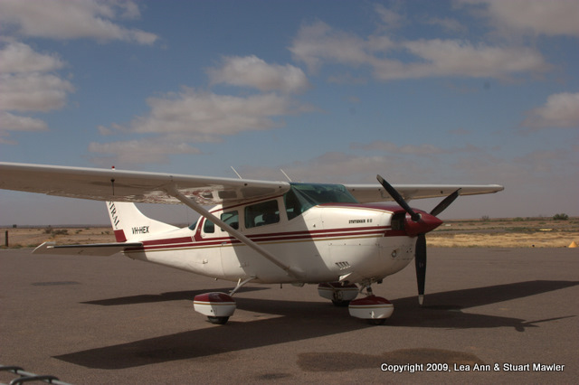
At the airport, we parked near the only plane that was ready to fly and which ended up being our plane.
Soon, we had the pleasure of meeting a fellow traveler (and immigrant to Australia) who would be joining us on the flight. We noticed that he seemed to be fiddling a great deal with his camera, so we asked about it.
He explained that his camera "got wet". It seems he had been out on the Birdsville Track the day before. Remember all that rain we mentioned? He was out in it. In a Subaru Outback. How appropriate, eh?
Except that a Subaru Outback has even less ground clearance than our Mitsubishi. Apparently, ground clearance became a problem when the water came up over the doors. Ah, that explains the wet camera equipment.
Fortunately for our fellow traveler, Australians are congenitally helpful. He explained that a local hooked the Subaru onto a much larger truck and then dragged the Subaru about one kilometer through deep water and mud, until they reached a reasonably dry portion of the track. That's going to leave a mark.
We offered to share pictures with our new friend, so he should rest assured that we have more! (Many, many more. And higher resolution, too.)
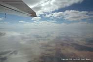
After the pilot arrived and had us sign the log book, we piled six people into the plane and set off into the wild blue yonder.
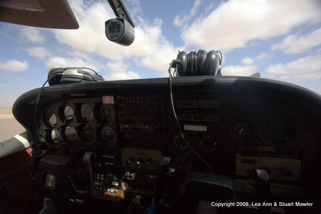
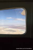
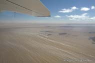
The picture above left shows the cockpit. The picture above right highlights something that most non-aviators probably do not know. The air vent in the upper left of the picture just goes right to the outside. When they say "unpressurized", they mean it.
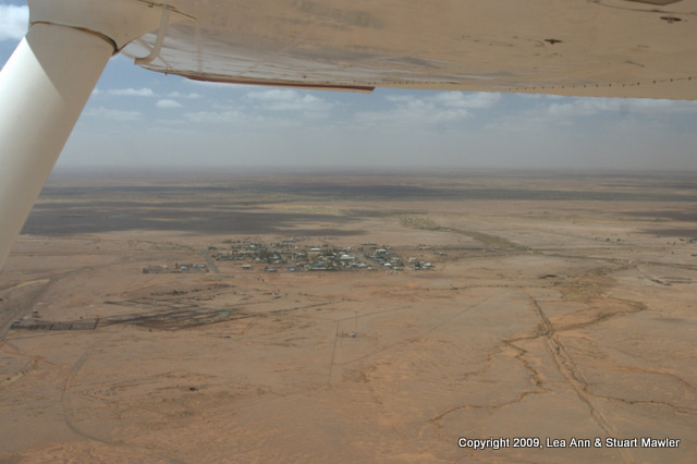
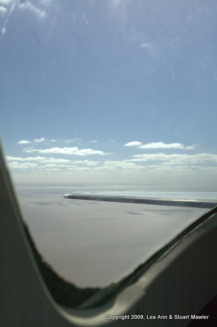
The picture above left shows the metropolis of Marree from Lea Ann's seat right up front under the wing. You can see the perfect little grid of a town, just like Adelaide and Farina.
Also, on the far left side of the picture, just below the wing strut, there is a grey triangle, like a road. This is actually a big loop that trains from the south would use to get turned around, so the engine would be in the front again. They clearly liked to see where they were going.
The picture above right is Lea Ann's view directly ahead. That grey triangle smudge to the left of center frame is the propeller in motion. Most of the rest of the pictures are significantly more abstract.
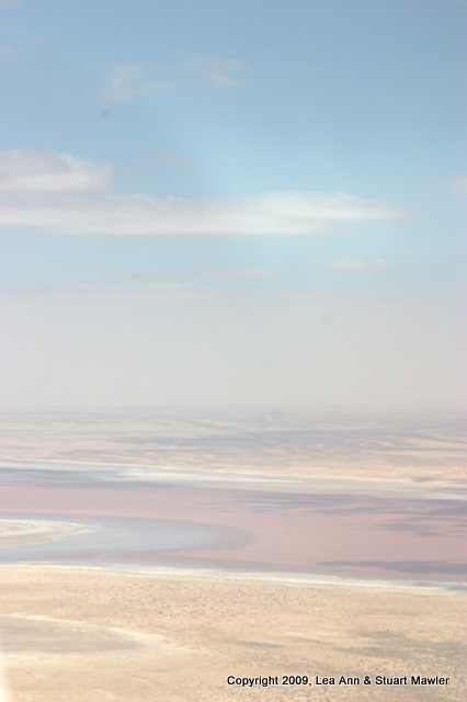
As it happens, 2009 was a very good year for the lake, reaching 1.5m in depth. Apparently, we did get a lot of rain... (and yes, we know it is not that simple, so stop harrumphing.)
The most important thing is that, with all that water, the lake was stunning. Our accidental side-trip turned out to be an excellent side-trip.
And it meant that we took nine planes on this trip.
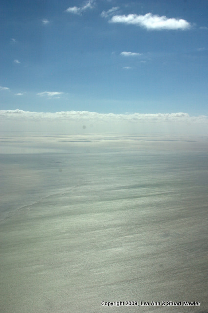
The following are some of the best abstractions with few breaks for annoying commentary. Most of the time, we know little about what is in the image. It was just stunning to see.
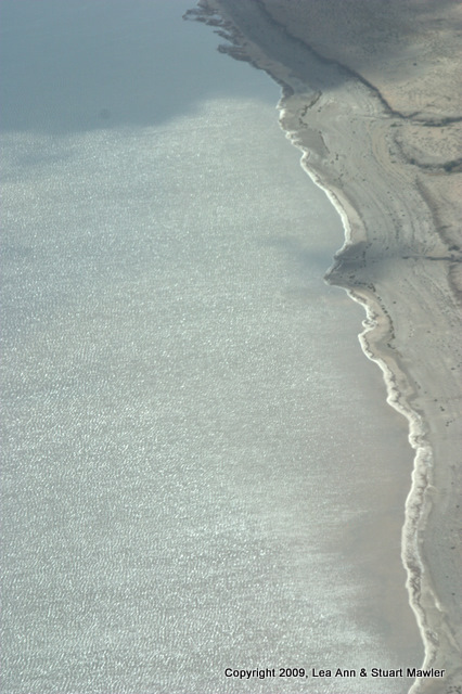
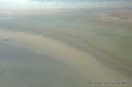
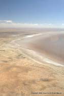
The above left picture is simply beautiful and speaks for itself. The two pictures above center and above right are essentially straight down on the ground. The picture above center actually has water in most of it, with a "beach" formed diagonally in the upper left.
The image above left is sun reflecting on water with salt streaks mixing in the middle. There is a little bit of "beach" in the upper left. The above center picture shows the red of minerals and algae. We assume that the above right image is of water...
The next few require no further explanation. Or, we should say, we have no further explanation.
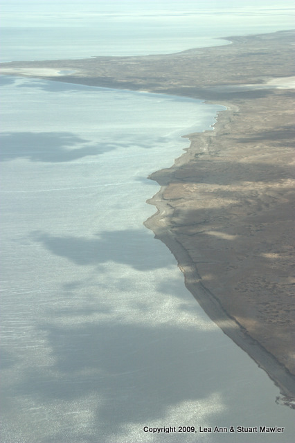
In the image above left, the white streaks are salt and the dark dots in the lower right are cloud shadows. In the image above right, the white is salt.
The image above left was taken moments before the image above right. They are essentially of the same area, where different parts of the lake come together.
Clearly, we were taking loads of pictures during this flight (and we are not done yet). But what was everyone else doing?
That's right, they were just as fantically taking pictures out the window, making feeble attempts to capture some element of what we were seeing. The fellow ahead on left with his hat on backwards is the driver of the Subaru. Clearly, one of his cameras worked.
The above picture shows something else: Stuart was in the back of the bus. He also had the wide angle lens.
You know, it is really hard to switch lenses sitting that far away in a plane that small. Is it an oxymoron to sit far away in a small place? Nevermind, you get the idea.
Sitting in the back gave a different perspective, but equally beautiful.
|
|
|
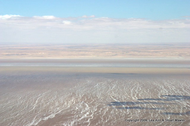
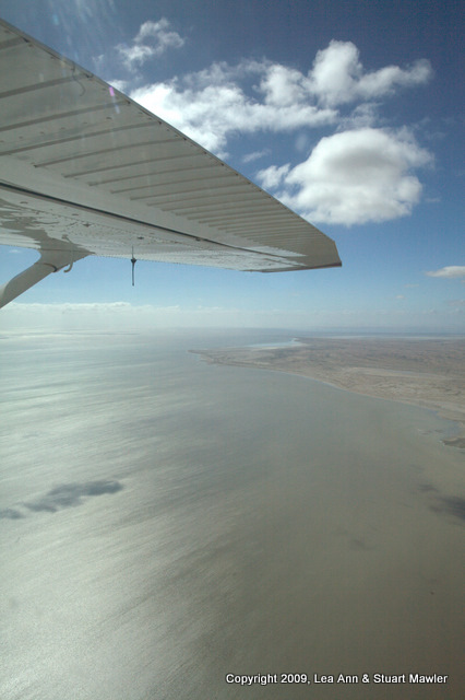
Water meets sky...
|
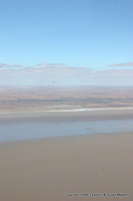
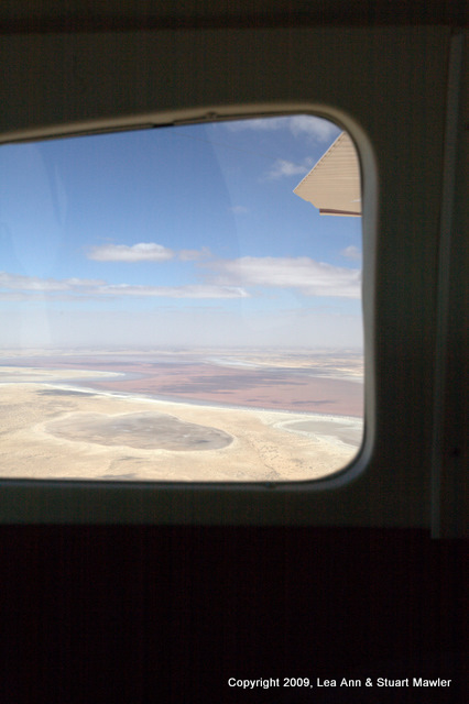
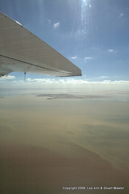
Through a side window...
|
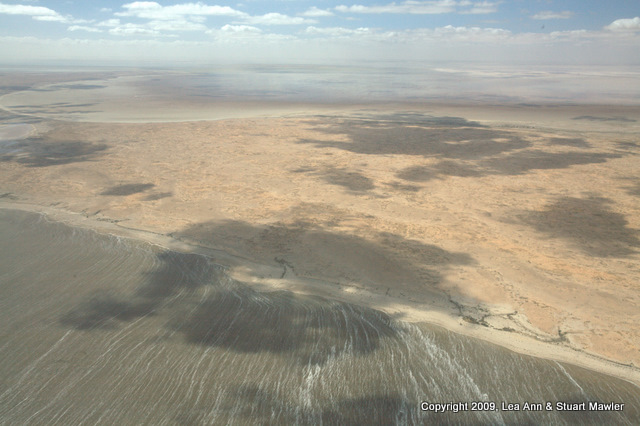
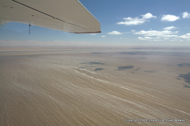
Shadows on the beach...
|
|
|
|
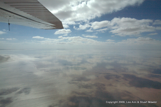
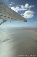
Sun glints under the wing...
|
Colorful water...
|
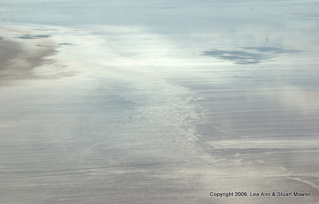
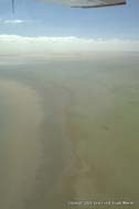
Currents meet...
|

|
|
|
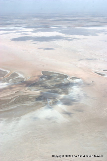
An island in the distance...
|
Salt streaks...
|
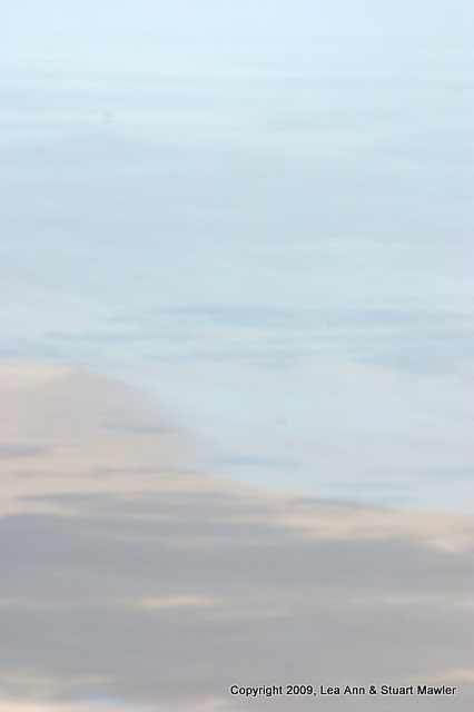
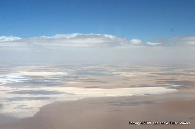
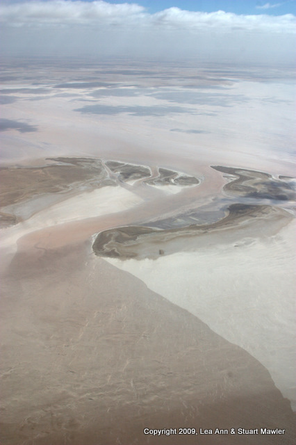
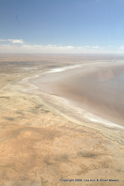
Lake pushed back from the beach by the wind...
|
|
|
Salt and shadow...
|
|
Is there anyone following us?
Nope.
|
|
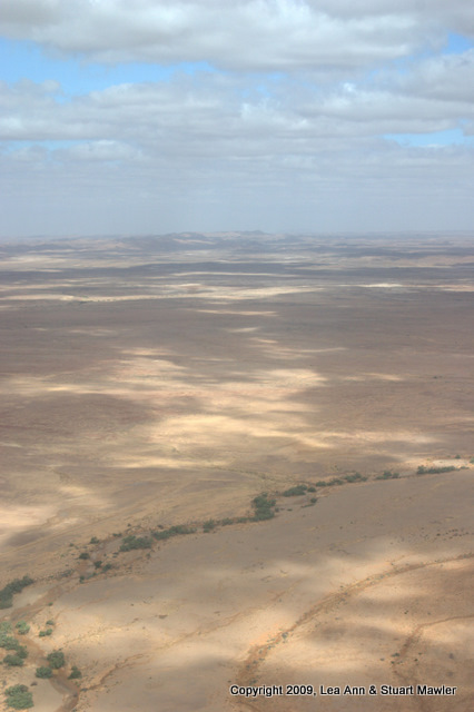
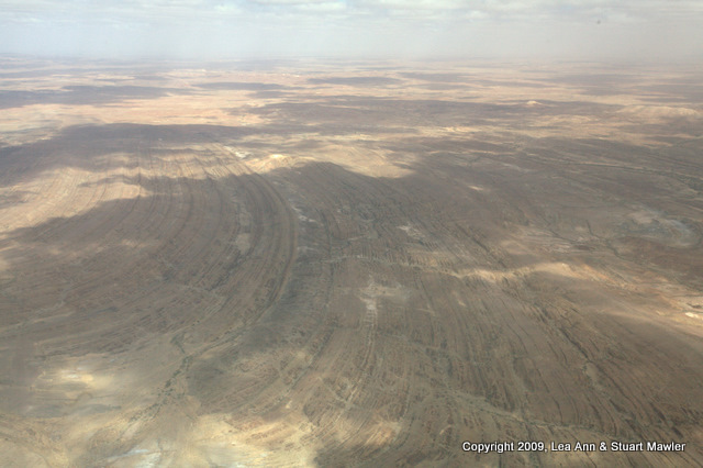
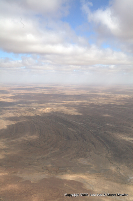
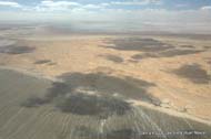
We eventually left the lake and headed back toward Marree. On this part of the trip, we were able to see some excellent land formations and a whole bunch of cool artifacts.
|
|
A "creek" in the foreground...
|
|
Excellent folds...
|
|
|
|
More folds in dappled light...
|
|
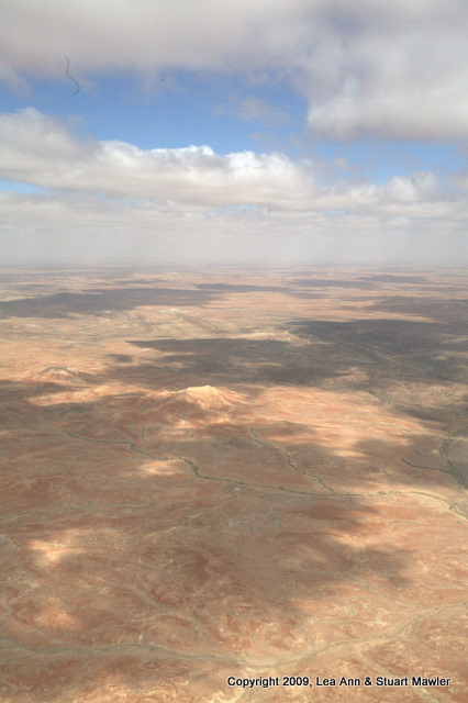
The sun highlights a salt dome on the red earth...
|
|
|
|
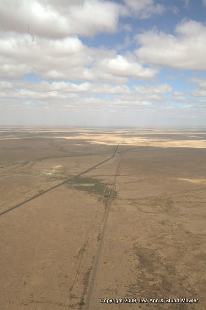
The way back to Parachilna...
(The paved road on the left, the Old Ghan on the right.)
|
|
An Old Ghan trestle along side the Oodnadatta Track...
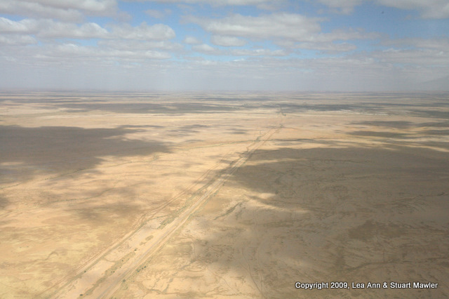
We will be hitting this mud hole soon...
(Floodway at bottom center)
|
|
|
|
The Oodnadatta Sculpture Garden from the air. Another thing we will soon see up close...
|
|
The Oodnadatta Track extending off into the far northwest, beyond where the eye can see. That is our route...
|
|
Good grief it was late... We had a long way to go yet and a bunch of things to photograph, for sure.
|