Mawlersĺ Big Adventure ĺ04:
Whitehorse to Simmons Lake
Sunday, 15 August 2004
|
|||
|
We get an early start today. Who am I kidding? We talked about getting an early start, but that did not exactly work out. Oh well, at least it is before noon. We go back to the Midnight Sun Coffee Roasters to get a refill on coffee and date bars. The swirling vortex of good coffee exerts a huge pull on us, but, with great effort, we are able to extract ourselves from the store. On this trip, we are going to drive down south on a side-trip off the Alaska Highway to Carcross. Fortunately, this is a loop, so we will not be backtracking. On the way, there are several interesting things to see, including the Emerald Lake and the Carcross Desert. The Emerald Lake is, well, green. Even in the haze, it is stunning, so we take some unusual artsy shots of the varying bands of emerald color. The Carcross Desert is actually a sandy spot caused by the remnants of an ancient lake bed. There are some very impressive dunes, though, and the little flowers growing there are quite pretty. While out taking pictures of the desert, we see a couple with an honest-to-goodness movie camera. You know, the kind that actually takes film. Contrary to our normal mode of operation, we decide to ask them about it. Even film buffs like us think it a bit odd to see people shooting motion pictures of stationary objects. Besides, Lea Ann has a camera just like it. (Are you surprised?) It turns out that the couple is from northern Germany and is making a documentary about the environment. (Again, are you surprised?) We talk about camera equipment and environmental issues, interspersed with camera issues and environmental equipment, for a few minutes and finally go our separate ways. We still have pictures left on the cameras, so it is not time to get back on the road yet. Loading new rolls of film into the cameras, we set off across the remaining few kilometers to Carcross itself. This is a cute little town that is the head of the highway and railroad from Skagway, Alaska. During World War II, it was also a US Air Force base. More importantly, they have good ice cream at the shop across from the museum, where we record another number for the Yukon Adventure Challenge. The problem is, you need to time your visit to Carcross very well to avoid the crush of tourists. The town population is probably around 500 people (many of whom commute to work in Whitehorse, apparently), but the tour groups drop in every so often and swell the population by nearly twice its normal size. People actually line up outside of the store with the ice cream, just to get a cone. Ok, it was good, but not that good. We sit around in the sun for a while, pet the resident dog in the museum, just enjoying the day, but finally decide to get back on the road. Before getting any farther along, we will need to get some gas, so we pull into the only gas station in Carcross. While I am filling the tank, Lea Ann is working on her laptop in the passenger seat. When I get back to the car, having paid, she asks if we can wait just a sec before pulling away. It seems that she is surfing the web off someoneĺs unencrypted wireless router. Not being one to look a gift router in the mouth, I (correctly) assume that the gas station must have the wireless router, so I pull up to the side of the store, where the signal is better. Of course, where else would the signal originate? The trees? Just to review: We are in a territory where the permanent population is less than 30,000 people, in a town with about 500 people, sitting in our car and Lea Ann is surfing the web on a laptop running on AC power. Ah, technology.
We hurry up the rest of the loop back to the Alaska Highway since there are still many kilometers left to go. Also, Lea Ann is looking forward to visiting the Tlingit Cultural Museum; we have gone by museums galore and some, like the museum in Burwash Landing, turned out to be pretty good, but most are just not that interesting, since there is such great stuff to see out the car window. This one, however, has the potential for some great art, so our interest is piqued. Naturally, the museum is closed. It seems that someone is having a wedding today. Just goes to show that you cannot expect something to be open, just because they say it is. At least we do not need a passport stamp here, because that requires the building to be open. We collect the Yukon Adventure Challenge number, take a few pictures of the totem poles out front, and walk around the building, staring in all the windows. We cannot see anything interesting through the windows since they all seem to look into the meeting space or the offices. Somewhat irritated, we finally get going. Next on the list is the George Johnston Museum and we need a stamp for the Yukon Passport, so we are hoping they are not having a wedding, funeral, bat mitzvah, or something else. When we get there, we are pleased to find that it is open, as advertised and has some excellent art, including the stuff for sale in the gift shop. George Johnston, I should mention, was a native photographer (he was both a native and took pictures of natives). He was also one of the first people to have a car in the Yukon. Let me drive that point home: Mr. Johnston bought his car before there were any roads. He waited until the winter freeze and just drove on the lakes and rivers. Naturally, the central exhibit at the museum is the car, which has been restored quite well. They point out that restoration was not that difficult because the car was in perfect shape when George Johnston finally traded it in. With tales like that, I am starting to feel a little self-conscious about the Jeep parked outside, sporting a sparkly windshield, scratches on the roof, etc. On the road again, we scan for interesting items that are close to the road. We decide that Rancheria Falls fits the bill, so we stop. It is a pretty little place, but the most interesting part is the extensive elevated boardwalk out to the falls. Somewhere around the falls, we start to notice some dense haze. Turns out, we are driving right into some very thick smoke. We cannot really see very far off the road and it just gets worse as we head toward Watson Lake. Arriving in Watson Lake, our eyes practically watering from the smoke, we finally complete the Yukon Passport game with a visit to the Northern Lights Centre. We quickly get back in the car and cross the street to complete the Yukon Adventure game at the Visitorsĺ Center. We were a little worried that all the locations would be closed before we arrived, but we made it.
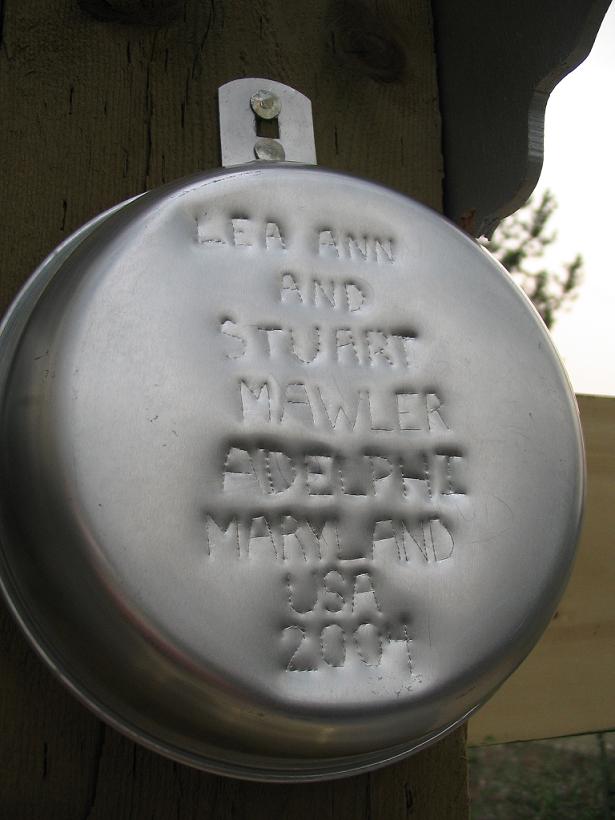
Having completed our big tasks, we can finally put our mess kit to good use. It is a tradition that travelers through Watson Lake will put up a sign in the signpost forest. Some people just write a sign with a marker. Some people pay to have a sign painted. We choose to make a sign that will not fade over the years. We sit together outside the Visitorsĺ Center, pressing our names, home town, and date into the bottom of the mess kit with the awl from my multi-tool. Yes, the very same multi-tool that I was using to eat noodles a few weeks ago in Eagle Plains. If you are ever up in the Yukon, see if you can find it. Then add your own! (Your own sign, that is.) Now we are really done. We have completed the two scavenger hunts, put up our own sign and driven all of the Alaska Highway inside Canada. Time for dinner. (It would be time for beer, but somebody needs to drive.) Having been to this town before, we are not expecting much, but we drive around the townĺs few streets hoping to find something to eat. We are rewarded by seeing the main street from a new angle (mostly because we have never seen it in daylight), revealing a drive-up / carry-out place that is probably the only good restaurant in Watson Lake. You can tell it is good because all the patrons are locals. The woman at the register says she has been in town for seven (7) years and she thinks this is the only good restaurant. I am tempted to ask what brought her to this place and managed to keep her for seven years, but that seemed a bit personal. Back when we crossed from Alaska to the Yukon, we talked to a fellow from Easton, Maryland. This conversation spurred our interest in the Stewart-Cassiar Highway, so we get gas (to go with the take-out) and back-track a few kilometers up the Alaska Highway and take a left, going south on the Stewart-Cassiar. Not having thought about this road as a part of the trip, we have no idea where to go, what to seeŚnothing. So, we basically drive until we get tired. It just so happens that there are lakes all along the road, so we find one called Simmons Lake and set up camp. The price is definitely rightů Free. Stewart-Cassiar is very laid-back compared to the Alaska Highway. Our plan, such as it is, for tomorrow, is to take pictures of the lake by daylight and then drive all the way down the road to the Yellow Head Highway, or possibly Prince George, so that we can make sure to leave plenty of time to visit our friends in Fort MacLeod. |
|||
|
|
|||
 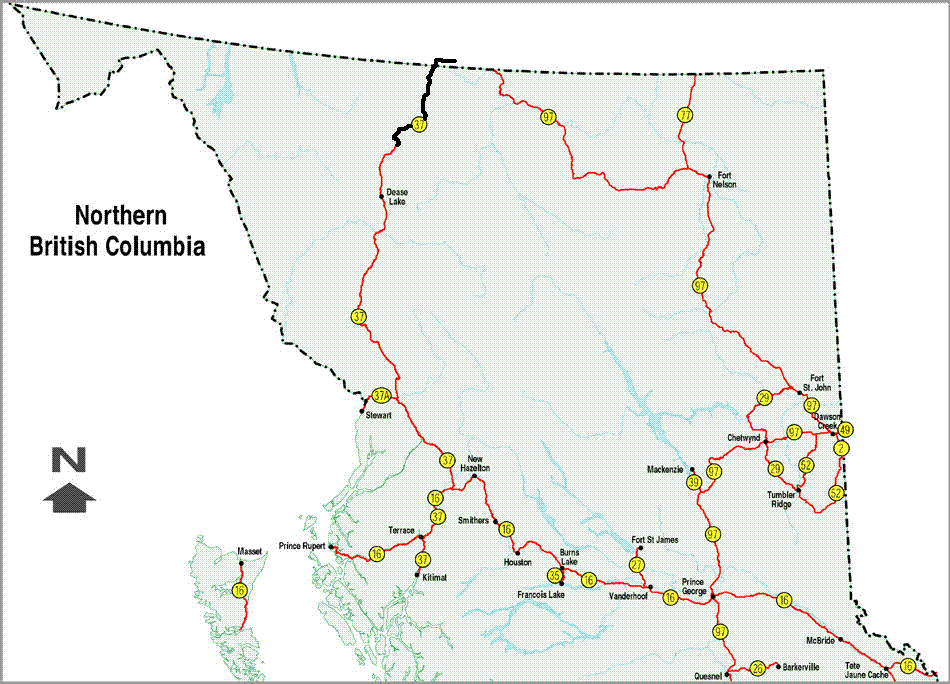 see it on a map |
|||
|
|
|||
|
The previous installment: |
The next installment: |
||

Back to Great White North Trip main page
Back to Mawler Home
All materials © 2004 Lea Ann Mawler & Stuart Mawler